International Lecture


The 12th ISDE International Lectures, with the theme of “Global Food-and-Water Security-support Analysis Data Using Multi-sensor Remote Sensing, Machine Learning, and AI on the Cloud”, was given on 9th September, 2024. Three speakers shared their research results about the Global Food-and-Water Security-support Analysis Data (GFSAD), Landsat-Derived Global Rainfed and Irrigated-Cropland Product @ 30m for USA (LGRIP30-USA), and crop type mapping using machine learning and AI on the cloud.
Theme: Global Food-and-Water Security-support Analysis Data Using Multi-sensor Remote Sensing, Machine Learning, and AI on the Cloud
Date & Time: 9th September, 2024, 18:00-19:30 (USA Pacific Standard Time)
Organized by: International Society for Digital Earth
Supported by:
International Research Center of Big Data for Sustainable Development Goals
International Journal of Digital Earth
Big Earth Data
Invited Speakers:
Prasad S. Thenkabail (United States Geological Survey)
Pardhasaradhi Teluguntla (United States Geological Survey)
Itiya Aneece (United States Geological Survey)
Moderator:
Prasad S. Thenkabail (United States Geological Survey)
Programme:
Time Zone (USA Pacific Standard Time, PST) | |
18:00-18:05 | Welcome and Introduction |
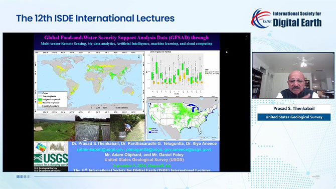
18:05-18:25 | Topic: Global Food-and-Water Security-support Analysis Data (GFSAD) Speaker: Prasad S. Thenkabail (United States Geological Survey) |
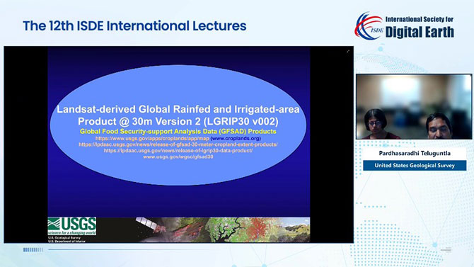
18:25-18:45 | Topic: Landsat-derived Global Rainfed and Irrigated-area Product @ 30m Version 2 (LGRIP30 v002) Speaker: Pardhasaradhi Teluguntla (United States Geological Survey) |
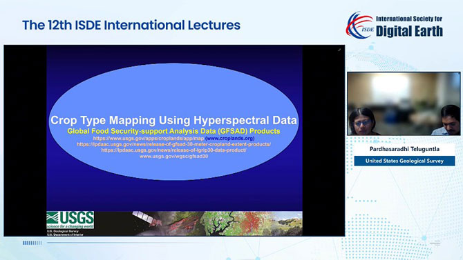
18:45-19:05 | Topic: Crop Type Mapping Using Hyperspectral Data Speaker: Itiya Aneece (United States Geological Survey) |
19:05-19:30 | Group Photo Q&A |
Short Bio of Invited Speakers:

Prasad S. Thenkabail
United States Geological Survey
Dr. Prasad S. Thenkabail is a Senior Scientist with USGS, specializing in remote sensing science for agriculture, water, and food security. He is a world-recognized expert in remote sensing science with multiple major contributions in the field sustained for over 38 years. Dr. Thenkabail has conducted pioneering research in hyperspectral remote sensing of vegetation and in that of global croplands and their water use for food security. In studies of global croplands for food and water security, he has led the release of the world’s first 30-m Landsat Satellite-derived global cropland extent product. This work demonstrates a “paradigm shift” in global cropland mapping using remote sensing through big data analytics, machine learning, and petabyte-scale cloud computing on the Google Earth Engine (GEE). He has edited two seminal Book-sets with a total of seven volumes, which have demonstrated his major contributions as an internationally acclaimed remote sensing scientist.

Pardhasaradhi Teluguntla
United States Geological Survey
Dr. Pardhasaradhi Teluguntla is a Senior Scientist with the Bay Area Environmental Research Institute (BAERI) @ USGS since 2013. He is one of the lead scientists who worked on the NASA-funded Global Food-and-Water Security-support Analysis Data @ 30m (GFSAD30) Project. He has over 20 years of experience in remote sensing science relevant to agriculture, water, and natural resource management. Prior to BAERI, he was a scientist at the International Maize and Wheat Improvement Center (CIMMYT), c/o ICRISAT, Hyderabad. He worked on mapping maize production zones and stress-prone target ecologies in South Asia under the Abiotic stress Tolerant Maize for Asia (ATMA) project. Dr. Teluguntla has worked as a senior scientific officer for the International Water Management Institute (IWMI) in India. He was one of the key researchers in the Krishna River Basin studies funded by the Australian Centre for International Agriculture Research (ACIAR), Govt. of Australia. He has worked extensively on global irrigated and rainfed area mapping and is an expert in big-data analytics, cloud computing, and Google Earth Engine (GEE). He has worked in over 20 countries and has extensive experience in crop water use (actual evapotranspiration) modeling.

Itiya Aneece
United States Geological Survey
Dr. Itiya Aneece is a Research Geographer at the USGS Western Geographic Science Center using hyperspectral and multispectral remote sensing to study globally dominant agricultural crops. She is also working on a variety of projects with the Astrogeology Science Center. Dr. Aneece earned a PhD in Environmental Sciences from the University of Virginia, where she conducted her dissertation research on studying the impacts of invasive plant species on secondary successional dynamics in abandoned agricultural fields using ground-level hyperspectral remote sensing. She has also recently completed a Mendenhall Postdoctoral Fellowship within the Western Geographic Science Center, in which she studied crops using Hyperion hyperspectral satellite data in Google Earth Engine.
Extended Materials:
About the previous ISDE International Lectures:
http://www.digitalearth-isde.org/list-34-1.html
About Global Crop Water Productivity and Savings through waterSMART (GCWP):
About Global Hyperspectral Imaging Spectral-library of Agricultural-Crops & Vegetation (GHISA):
About Global Food-and-Water Security-support Analysis Data (GFSAD):
Release of LGRIP30 Data Product:
https://lpdaac.usgs.gov/news/release-of-lgrip30-data-product/
Release of GFSAD 30 meter Cropland Extent Products:
https://lpdaac.usgs.gov/news/release-of-gfsad-30-meter-cropland-extent-products/